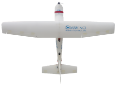
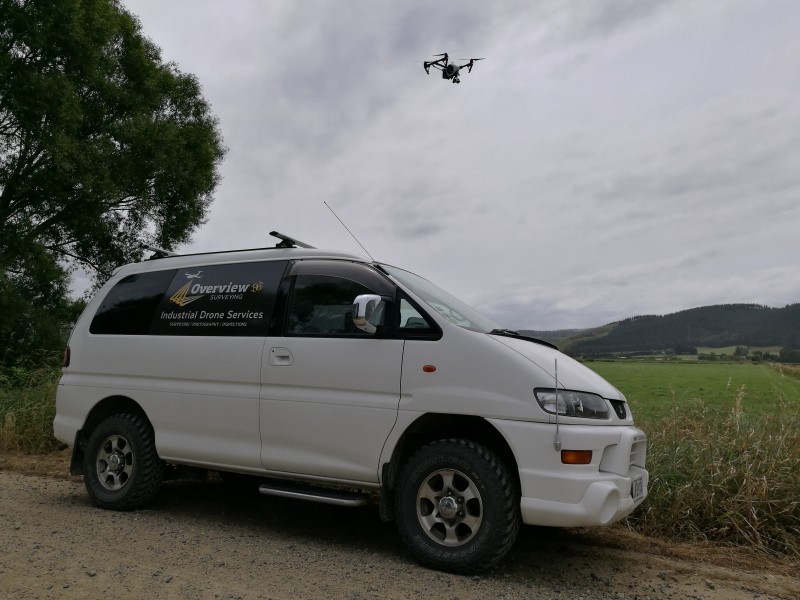
Overview Surveying offers services throughout New Zealand, and specialises in Topographic/3D Surveying and Survey Accurate Aerial Photography and LIDAR, using Unmanned Aircraft Systems (UAS).
Overview Surveying are also Part 102 Certified with the Civil Aviation Authority (CAA), allowing us to operate our Unmanned Aerial Vehicle (UAV) outside of the CAA Part 101 rules for unmanned aircraft. Part 102 Certification means we have demonstrated to the CAA that we have the appropriate procedures in place to identify, manage and mitigate the hazards and risks associated with operating our UAV outside of Part 101 rules.
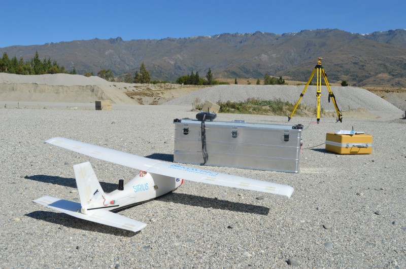
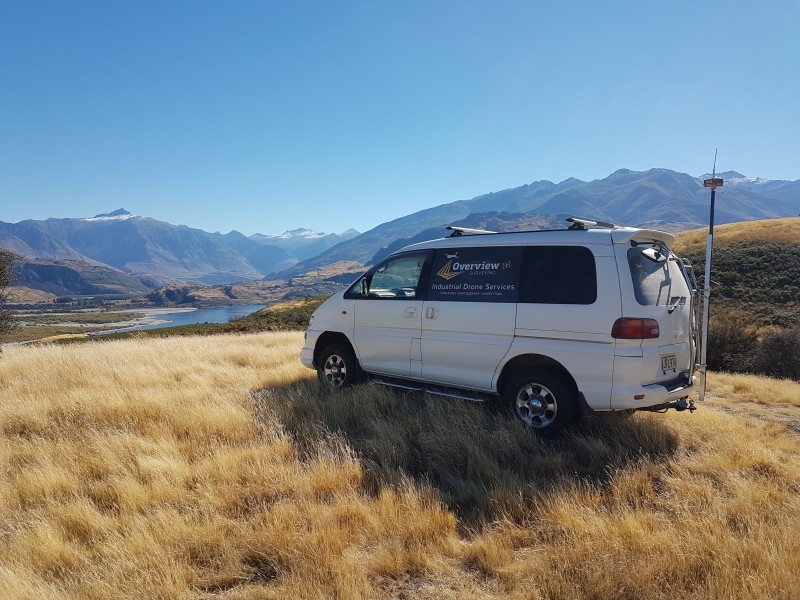
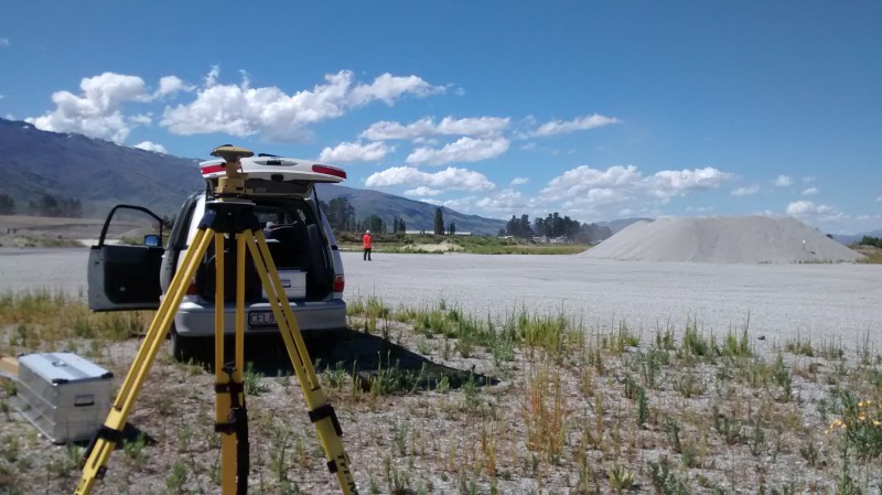
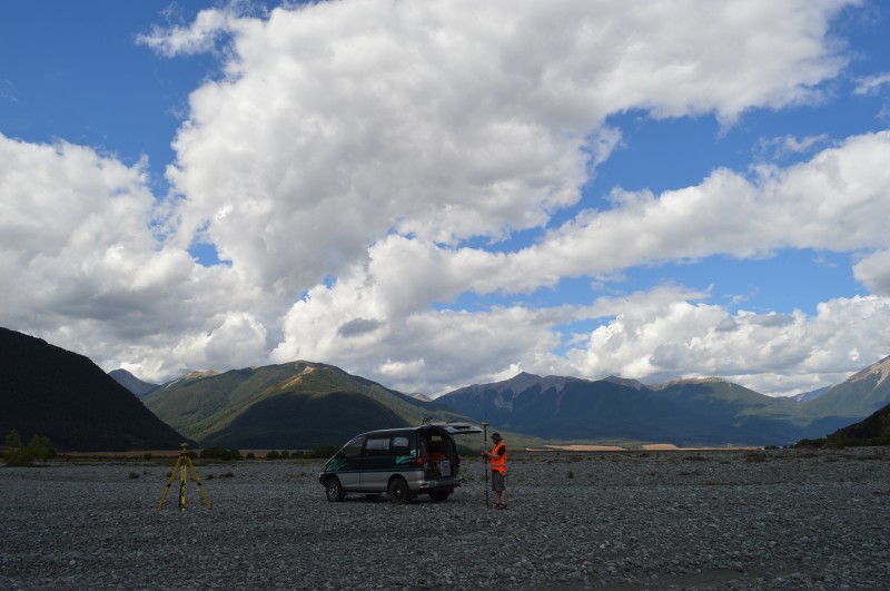
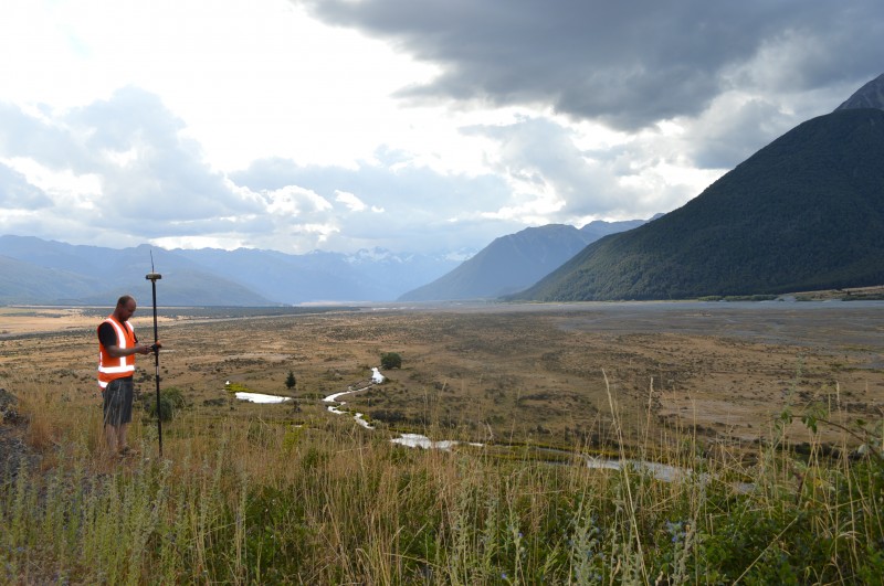
We are a fully qualified Surveyor run company that use a range of conventional and modern survey equipment, the most important being our UAS with onboard RTK-GPS (surveying grade GPS).
We can be sub-contracted to supply data to other Surveyors and Consultants for further analysis, or we can use the data to produce almost any deliverable you require.
Our clients can be assured that the quality of data supplied is of the highest standard - what you would expect from a Survey professional.
We can supply:
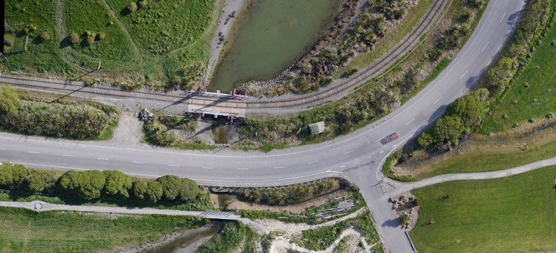
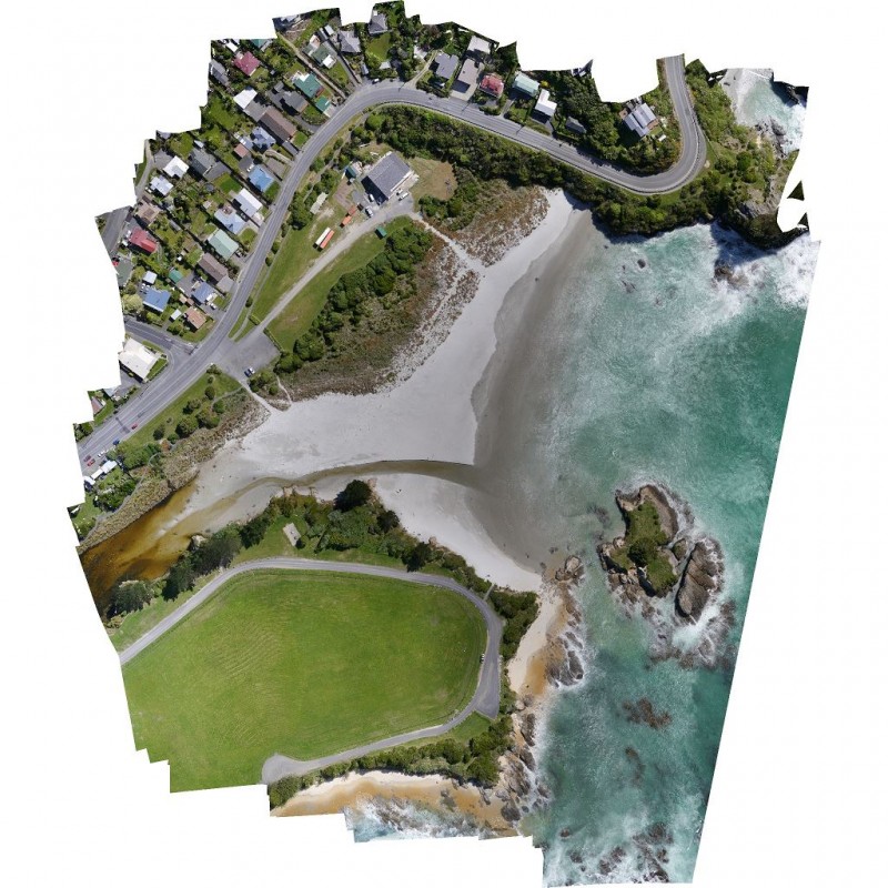
Aerial Photography (ortho-referenced - georeferenced, true to scale and measureable)
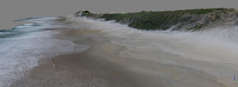
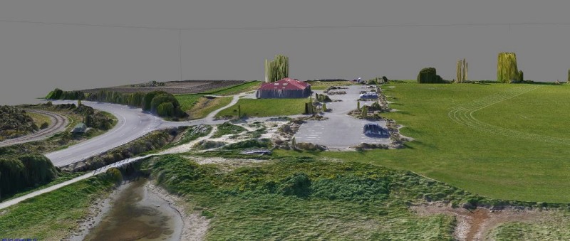
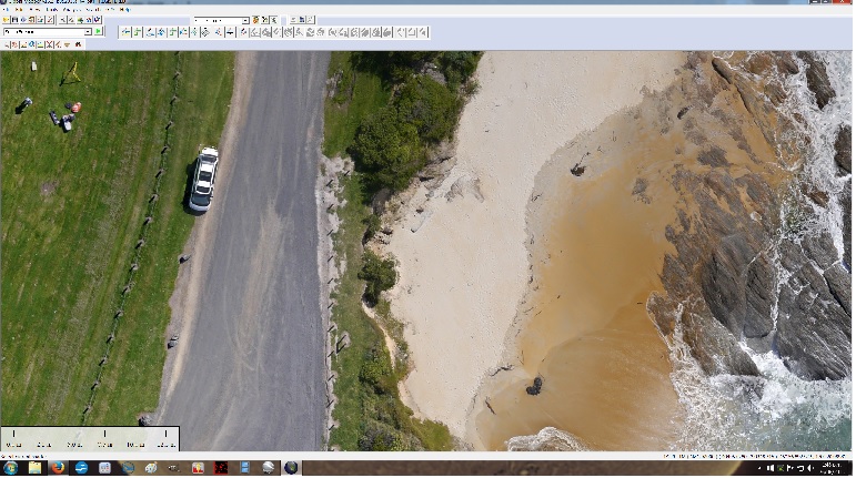
Point Cloud Data
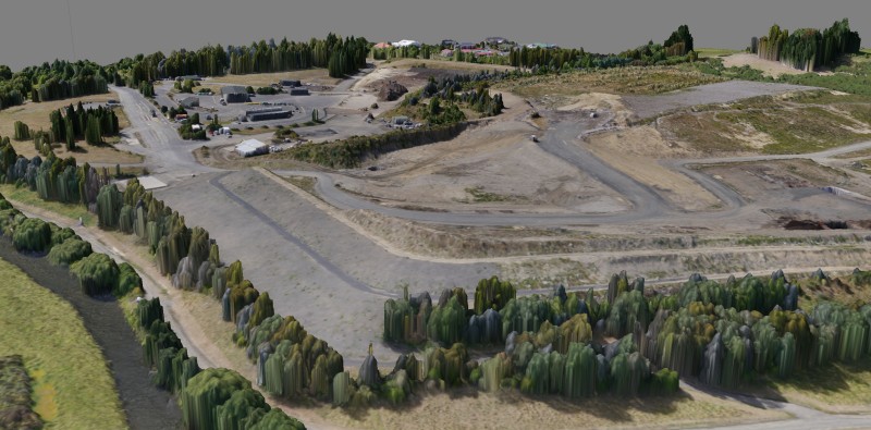
3D Surfaces in formats to suit all major software packages - with a reduced file size if required
Or we can use the data to supply solutions to meet your needs and to suit your existing software, producing the outputs you require, such as:
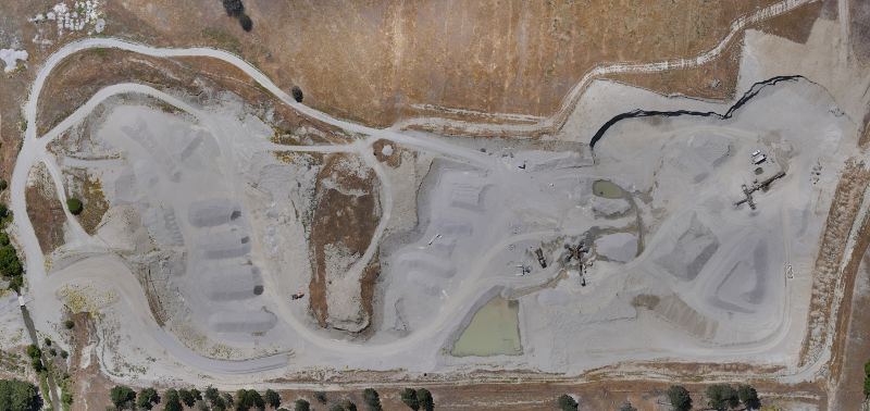
Stockpile Volumes
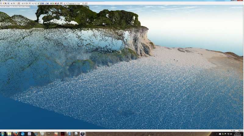
Topographic Survey Plans
Viewshed Analysis
Erosion Monitoring
Earthworks Volumes
Simplified Bare Earth Surfaces
There is an ever increasing focus on improving health and safety wherever possible. As companies look to achieve zero harm, Overview Surveying can help to eliminate the risk to Surveyors by completing the survey remotely from the air.
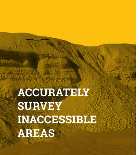
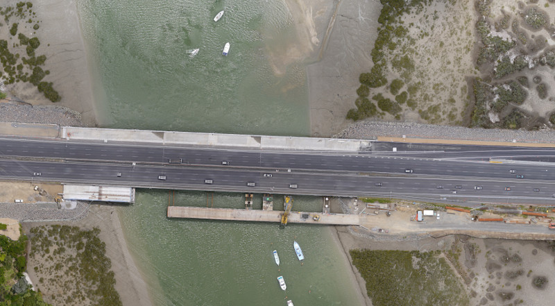
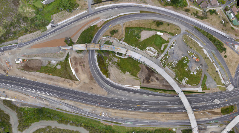
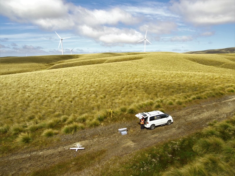
Unstable, dangerous or inaccessible areas such as stockpiles, slips or flooded areas can be surveyed without the risks associated with having a person physically on site taking measurements and collecting data. Aerial surveying is especially advantageous for mines, quarries and earthworks sites, improving safety by physically keeping Surveyors away from operating equipment and avoiding costly delays while work is disrupted to allow surveying work to be completed.
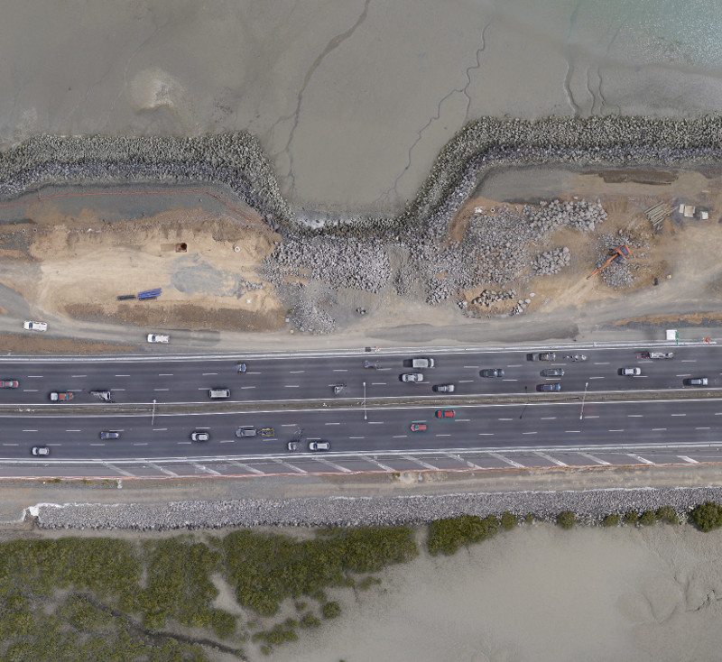
On roading construction sites, we can eliminate the need for time consuming traffic management. Traffic managment plans can involve limiting the number of traffic lanes in use, enforcing speed restrictions, and the inherent danger of having Surveyors working on busy roads.
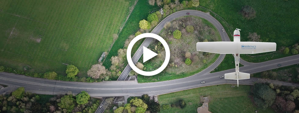
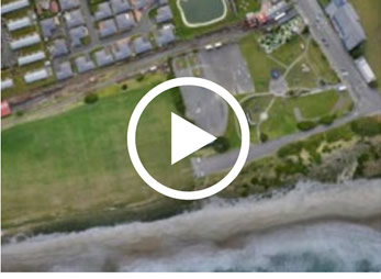
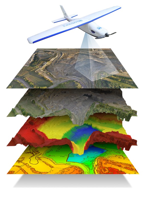
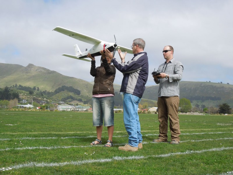
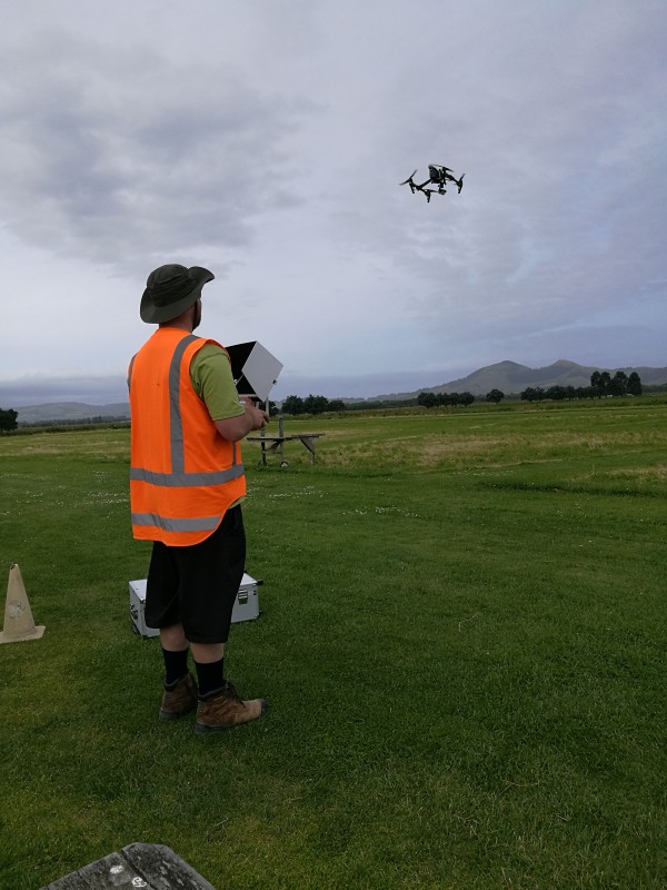
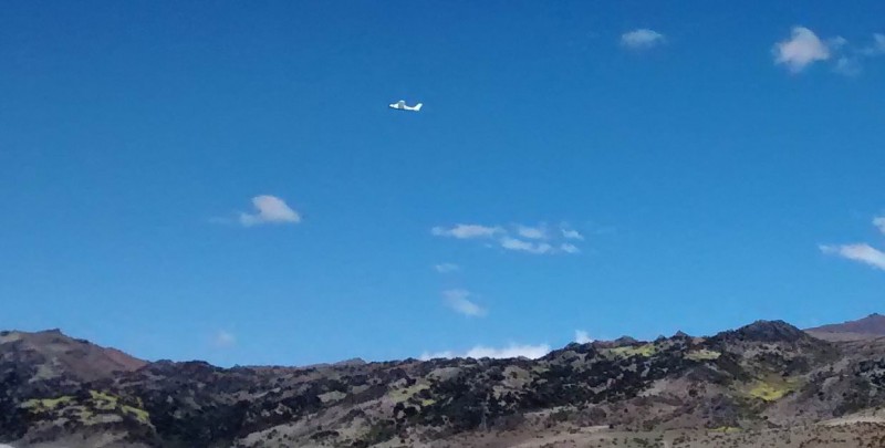
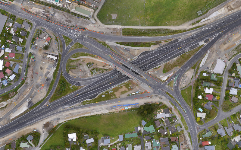
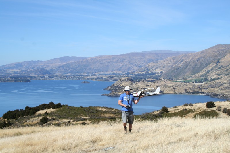
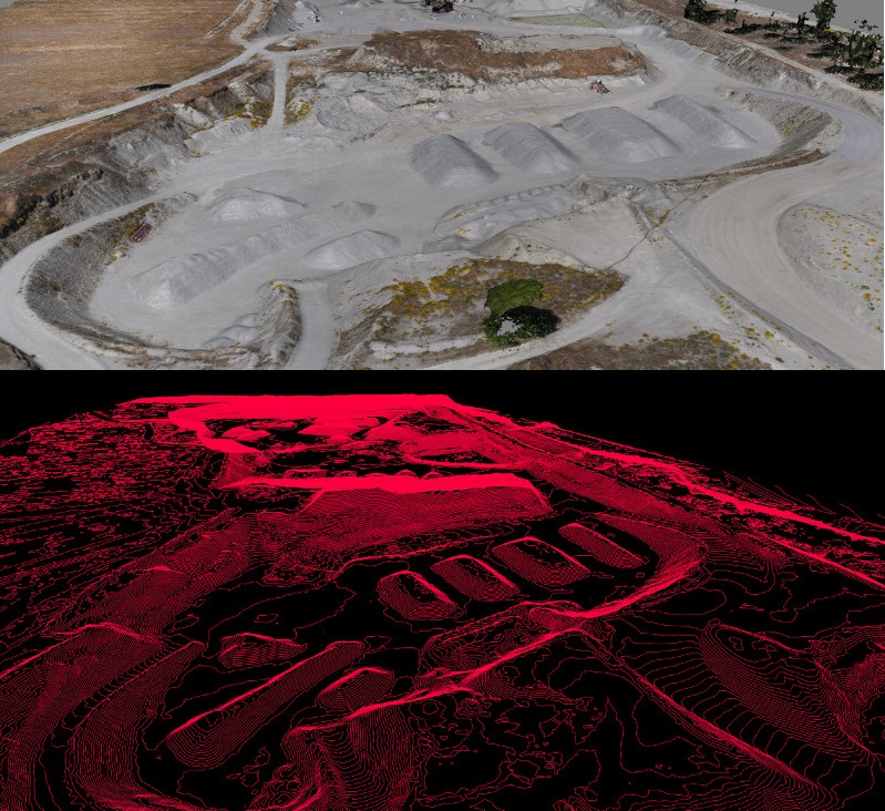
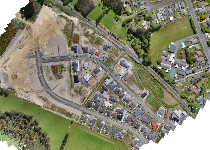
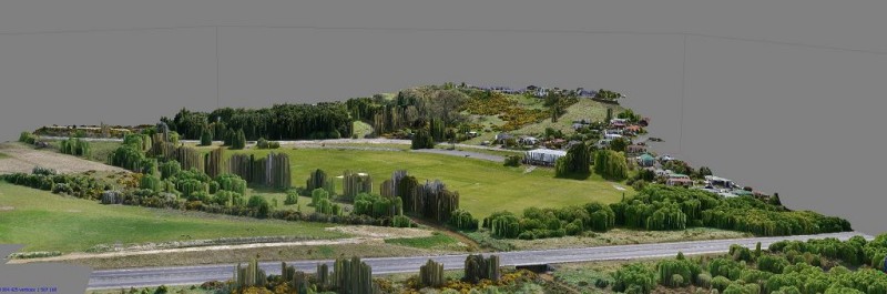
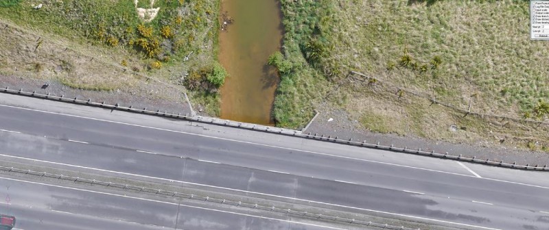
UAV Surveying works via photogrammetry - the Unmanned Aerial Vehicle (UAV) is flown in a set pattern above the area to be surveyed. As the UAV flies, the onboard camera takes a very large number of overlapping photographs. Our UAV, with onboard surveying grade RTK-GPS, also precisely measures the position from which the photographs are taken from during the flight. This data is then uploaded to our custom built, high performance computer using specialist software to be processed. A single geo-referenced to-scale aerial image is generated as well as a carpet of 3D survey points over the surface of the area being surveyed. Survey accurate measurements can be taken from the resulting image and point data.
We have invested in the software and a considerable amount of computing power to enable us to process our own data. We are in full control of the output quality and there is a fast turnaround (depending on the size of the site). Based on the required outputs, for a single flight job, we could have your data ready within 24 hours of flying the area of interest.
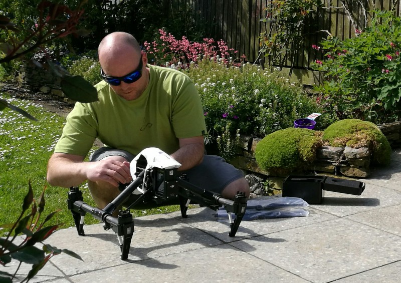
We have recently upgraded our UAV fleet, continuing to provide accurate survey data and services to our clients.
Updates to our website and services are in the works - give us a call to find out the latest...
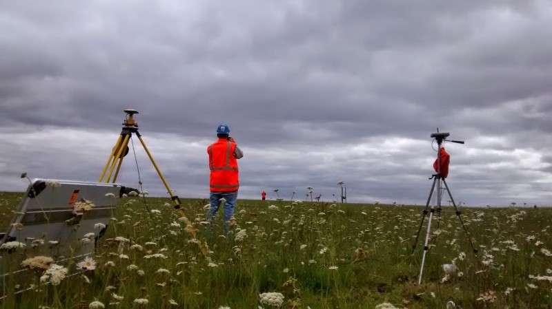
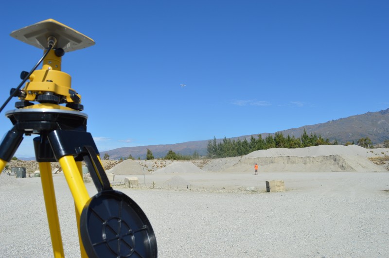
As part of our quality assurance process, we will further verify the accuracy of the data we collect by measuring check shots with an independent GNSS system. We stand by our work and are also backed by full Professional Idemnity Insurance.

UAVs are a powerful new Surveying tool. In the hands of a qualified Surveyor they can accurately survey and photograph large areas much faster and more comprehensively than ever before.
Applications:
To complement and enhance the UAV data, Overview Surveying can also employ a range of other surveying instruments including Aerial Lidar, Laser Scanners, RTK GPS and Total Stations to capture any spatial data you need as accurately as you require.
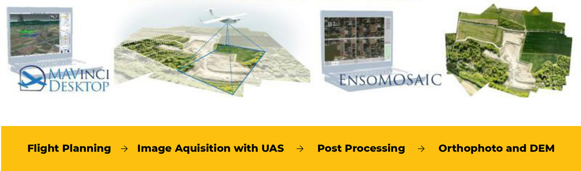
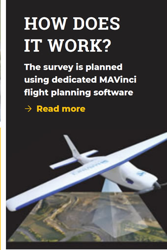
STEP 1:
The survey is planned using dedicated flight planning software...
A number of details can be manipulated at this stage, such as the altitude of the flight (which determines photo resolution and ultimately the accuracy of the final output) and the orientation of the flight plan (to take in to consideration prevailing wind direction or terrain features). The flight plan is then tailored to the terrain. If the job is very large it may be broken down into multiple flights to allow for battery changes and for the pilot to reposition to allow for line of sight flying. Once on site, the flight plan is reviewed and after checking for hazards and assessing the actual wind conditions (the flight plan can be updated if necessary), it is then uploaded to the UAV.
STEP 2:
Numerous overlapping images are captured and GPS positions are logged of where each image was taken from. The flight is monitored by the UAV pilot and should the unexpected occur (such as a helicopter/plane entering the area) the UAV pilot can steer the UAV away from danger and land if necessary.
STEP 3:
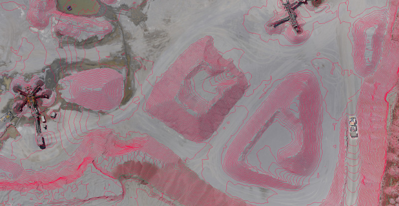
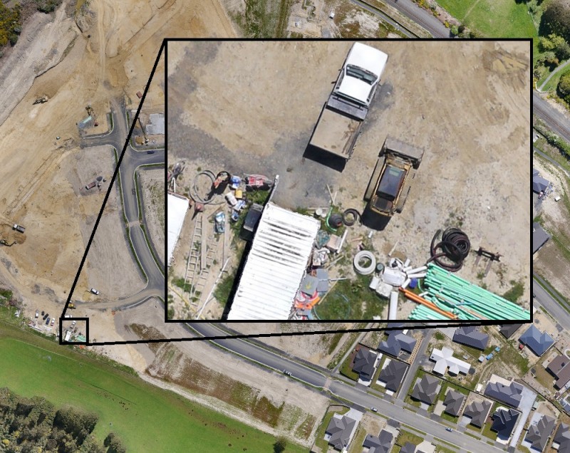
The overlapping images are then post-processed and are used to build a single ortho-referenced aerial image of the entire job...
Depending on the clients requirements a full 3D point cloud of the entire area can also be generated. This point cloud can then be used to generate digital surfaces in almost any format. The aerial image can also be draped over the surface. If required the data can be refined further to include only ground points. Contour models of the ground can be generated and topographical features can be extracted as required. At this time, volume analysis of stockpiles or terrain features can be calculated.

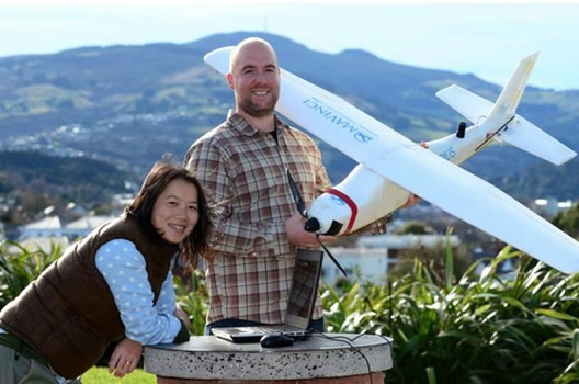

Overview Surveying is operated by Jared & Siem Reeves
Jared graduated with a Bachelor of Surveying from the University of Otago in 2001. Since then, he has worked in both Wellington and Dunedin for Survey Consultancies involved in a wide range of Cadastral, Topographical and Engineering Surveying. Prior to starting Overview Surveying in 2014, he was employed by a major construction firm specialising in Roading and Civil Engineering Surveying. He is also an Associate Member of Survey and Spatial NZ - Tātai Whenua (formally the NZ Institute of Surveyors).
Jared predicted that Aerial UAV Surveying and Scanning would become an important sub-discipline of Surveying and has spent the last several years becoming a specialist in the use of current and emerging spatial data acquisition technology. He has travelled all over New Zealand completing surveys for a range of clients and has had the privilege to experience and work in some of the most interesting, remote, and stunning landscapes that Aotearoa has to offer.
As part of his training to become UAV operator and pilot, Jared obtained his MFNZ Wings badge, FRTO licence and has completed a CAA endorsed RPAS course.
Siem graduated with a Bachelor of Science from the University of Otago, a Diploma of Teaching from the Wellington College of Education and also studied at the Otago Institute of Sport and Adventure. Her experience includes working on the Landonline project, teaching English in Japan and Ski Instructing in Canada. She is now a UAV co-pilot and Survey assistant.
We also have access to a range of other tools enabling us to capture almost any spatial data or aerial imaging you could need, including:
These will allow us to conduct:


Jared Reeves
Bachelor of Surveying
Associate Member of Survey and Spatial NZ - Tātai Whenua (formally NZ Institute of Surveyors)
Phone: 03 456 2907
Mobile: 021 1745 685
Email: jared@overviewsurveying.co.nz
